South Island of New Zealand | New Zealand Tourism

The South Island is sometimes called the "mainland". While it has a 33% larger landmass than the North Island, only 24% of New Zealand's 4.4 million inhabitants live in the South Island. In the early stages of European (Pākehā) settlement of the country, the South Island had the majority of the European population and wealth due to the 1860s gold rushes. The North Island population overtook the South in the early 20th century, with 56% of the population living in the North in 1911, and the drift north of people and businesses continued throughout the century.
Fact of South Island of New Zealand | New Zealand Tourism:

Location:
OceaniaCoordinates:
43°59′S 170°27′EArchipelago:
New ZealandArea:
151,215 km2 (58,384.4 sq mi)Highest elevation:
3,754 m (12,316 ft)Highest point:
Aoraki/Mount CookISO 3166-2:NZ:
NZ-SLargest city:
Christchurch (pop. 390,300)Ethnic groups:
European, MāoriWeather of South Island of New Zealand:
Naming and usage:

In the 19th century, some maps named the South Island as Middle Island or New Munster, and the name South Island or New Leinster was used for today's Stewart Island/Rakiura. In 1907 the Minister for Lands gave instructions to the Land and Survey Department that the name Middle Island was not to be used in future. "South Island will be adhered to in all cases".
'The South Island'
The South Island takes the definite article when used as a noun, whereas maps, headings or tables and adjectival expressions use South Island, similar to the United Kingdom.
South Island of New Zealand Tourism:

An increase in direct international flights to Christchurch, Dunedin and Queenstown has boosted the number of overseas tourists.
Fiordland National Park, Abel Tasman National Park, Westland National Park, Aoraki/Mount Cook National Park, Queenstown, Kaikoura and the Marlborough Sounds are regarded as the main tourism destinations in the South Island and amongst the Top 10 destinations in New Zealand.
Ski areas and resorts:
This is a list of ski areas and resorts in the South Island.
| Name | Location | Notes |
| Awakino ski area | Otago | Club Skifield |
| Broken River | Canterbury | Club Skifield |
| Cardrona Alpine Resort | Otago | |
| Coronet Peak | Otago | |
| Craigieburn Valley | Canterbury | Club Skifield |
| Fox Peak | Canterbury | Club Skifield |
| Hanmer Springs Ski Area | Canterbury | Club Skifield |
| Invincible Snowfields | Otago | Helicopter access only |
| Mount Cheeseman | Canterbury | Club Skifield |
| Mount Dobson | Canterbury | |
| Mount Hutt | Canterbury | |
| Mount Olympus | Canterbury | Club Skifield |
| Mount Potts | Canterbury | Heliskiing and snowcatting only |
| Mount Robert | Tasman | Club Skifield |
| Ohau | Canterbury | |
| Porter Ski Area | Canterbury | |
| Rainbow | Tasman | |
| The Remarkables | Otago | |
| Round Hill | Canterbury | |
| Snow Farm | Otago | cross-country skiing |
| Snow Park | Otago | |
| Tasman Glacier | Canterbury | Heliskiing |
| Temple Basin | Canterbury | Club Skifield |
| Treble Cone | Otago |
Transport in New Zealand:
Road transport:

Rail transport in New Zealand:
The South Island's railway network has two main lines, two secondary lines, and a few branch lines. The Main North Line from Picton to Christchurch and the Main South Line from Lyttelton to Invercargill via Dunedin together comprise the South Island Main Trunk Railway. The secondary Midland Line branches from the Main South Line in Rolleston and passes through the Southern Alps via the Otira Tunnel to the West Coast and its terminus in Greymouth. In Stillwater, it meets the other secondary route, the Stillwater - Westport Line, which now includes the Ngakawau Branch.

Passenger services were once extensive. Commuter trains operated multiple routes around Christchurch and Dunedin, plus a service between Invercargill and Bluff. Due to substantial losses, these were cancelled between the late 1960s and early 1980s. The final services to operate ran between Dunedin and Mosgiel, and they ceased in 1982. Regional passenger trains were once extensive, but are now limited to the TranzCoastal from Christchurch to Picton and the TranzAlpine from Christchurch to Greymouth.
The Southerner between Christchurch and Invercargill, once the flagship of the network, was cancelled on 10 February 2002. Subsequently, the architecturally significant Dunedin Railway Station has been used solely by the TGR's tourist trains, the Taieri Gorge Limited along the Otago Central Railway and the Seasider to Palmerston. Rural passenger services on branch lines were provided by mixed trains and Vulcan/88 seater railcars but the mixeds had largely ceased to exist by the 1950s and the railcars were withdrawn in the mid-1970s.
The South Island saw the final use of steam locomotives in New Zealand. Locomotives belonging to classes long withdrawn elsewhere continued to operate on West Coast branches until the very late 1960s, when they were displaced by DJ class diesels. In comparison to most countries, where steam locomotives were last used on insubstantial rural and industrial operations, the very last services run by steam locomotives were the premier expresses between Christchurch and Invercargill: the South Island Limited until 1970 and the Friday and Sunday night services until 1971. This was due to the carriages being steam-heated. The final steam-hauled service in New Zealand, headed by a member of the JA class, ran on 26 October 1971.
Water Transport in New Zealand Ferry services:

Dunedin was the headquarters of the Union Steam Ship Company, once the largest shipping company in the Southern Hemisphere.
Ports and harbours:
Container ports:
Lyttelton (Christchurch), Port Chalmers (Dunedin)Other ports:
Nelson, Picton, Westport, Greymouth, Timaru, Bluff.Harbours:
Akaroa, Otago Harbour, Halfmoon Bay (Stewart Island/Rakiura), Milford Sound.Freshwater:
Queenstown and Kingston (Lake Wakatipu), Te Anau and Manapouri (Lake Manapouri)Air transport in New Zealand:
Airport Name of New Zealand:
| LOCATION | ICAO | IATA | AIRPORT NAME |
| Alexandra | NZLX | ALR | Alexandra Aerodrome |
| Ashburton | NZAS | ASG | Ashburton Aerodrome |
| Balclutha | NZBA | Balclutha Aerodrome | |
| Blenheim | NZWB | BHE | Blenheim Airport (Woodbourne) |
| Chatham Islands | NZCI | CHT | Chatham Islands / Tuuta Airport |
| Christchurch | NZCH | CHC | Christchurch International Airport (long-distance) |
| Cromwell | NZCS | Cromwell Racecourse Aerodrome | |
| Dunedin | NZDN | DUD | Dunedin International Airport (limited) |
| Gore | NZGC | Gore Aerodrome | |
| Greymouth | NZGM | GMN | Greymouth Airport |
| Haast | NZHT | Haast Aerodrome | |
| Hokitika | NZHK | HKK | Hokitika Airport |
| Invercargill | NZNV | IVC | Invercargill Airport |
| Kaikoura | NZKI | KBZ | Kaikoura Aerodrome |
| Lake Pukaki | NZGT | GTN | Glentanner Aerodrome |
| Milford Sound | NZMF | MFN | Milford Sound Airport |
| Mount Cook | NZMC | MON | Mount Cook Aerodrome |
| Motueka | NZMK | MZP | Motueka Aerodrome |
| Nelson | NZNS | NSN | Nelson Airport |
| Oamaru | NZOU | OAM | Oamaru Aerodrome |
| Picton | NZPN | PCN | Picton Aerodrome |
| Queenstown | NZQN | ZQN | Queenstown Airport (limited) |
| Rangiora | NZFF | Forest Field Aerodrome | |
| Stewart Island/Rakiura | NZRC | SZS | Ryans Creek Aerodrome |
| Takaka | NZTK | KTF | Takaka Aerodrome |
| Te Anau / Manapouri | NZMO | TEU | Manapouri Aerodrome |
| Timaru | NZTU | TIU | Richard Pearse Airport |
| Twizel | NZUK | TWZ | Pukaki Aerodrome |
| Wanaka | NZWF | WKA | Wanaka Airport |
| Westport | NZWS | WSZ | Westport Airport |
| Wigram | NZWG | Wigram Aerodrome |
Geography of South Island, New Zealand:

Geology of South Island, New Zealand:

The 22 February 2011 Christchurch earthquake of 6.3 magnitude caused far more additional damage in Christchurch, including about 230 deaths. This quake struck at about lunchtime and was centred closer at Lyttleton, and shallower than the prior quake, consequently causing extensive damage.
Climate of South Island, New Zealand:
The climate in the South Island is mostly temperate. The Mean temperature for the South Island is 8 °C (46 °F). January and February are the warmest months while July is the coldest. Historical maxima and minima are 42.4 °C (108.3 °F) in Rangiora, Canterbury and −21.6 °C (−6.9 °F) in Ophir, Otago.
Conditions vary sharply across the regions from extremely wet on the West Coast to semi-arid in the Mackenzie Basin of inland Canterbury. Most areas have between 600 and 1600 mm of rainfall with the most rain along the West Coast and the least rain on the East Coast, predominantly on the Canterbury Plains. Christchurch is the driest city receiving about 640 mm (25 in) of rain per year. The southern and south-western parts of South Island have a cooler and cloudier climate, with around 1400–1600 hours of sunshine annually; the northern and north-eastern parts of the South Island are the sunniest areas and receive approximately 2400–2500 hours.
Protected areas of the South Island:
Forest Parks of South Island of New Zealand:

Catlins Forest Park:
Situated in the Southland region.Craigieburn Forest Park:
Situated in the Canterbury region, its boundaries lie in part alongside State Highway 73 and is adjacent to the eastern flanks of the Southern Alps. The Broken River Ski Area and the Craigieburn Valley Ski Area lie within its borders. The New Zealand Forest Service had used the area as an experimental forestry area and there is now an environmental issue with the spread of wilding conifers.Hanmer Forest Park:
Situated in the Canterbury region.Lake Sumner Forest Park:
Situated in the Canterbury region.Mount Richmond Forest Park:
Situated in the Marlborough region.Victoria Forest Park:
Situated in the West Coast region.National parks of South Island of New Zealand:

From north to south, the National Parks are:
Kahurangi National Park:
(4,520 km², established 1996) Situated in the north-west of the South Island, Kahurangi comprises spectacular and remote country and includes the Heaphy Track. It has ancient landforms and unique flora and fauna. It is New Zealand's second largest national park.Abel Tasman National Park:
(225 km², established 1942) Has numerous tidal inlets and beaches of golden sand along the shores of Tasman Bay. It is New Zealand's smallest national park.Nelson Lakes National Park:
(1,018 km², established 1956) A rugged, mountainous area in Nelson Region. It extends southwards from the forested shores of Lake Rotoiti and Rotoroa to the Lewis Pass National Reserve.Paparoa National Park:

Arthur's Pass National Park:
(1,144 km², established 1929) A rugged and mountainous area straddling the main divide of the Southern Alps.Westland Tai Poutini National Park:
(1,175 km², established 1960) Extends from the highest peaks of the Southern Alps to a wild remote coastline. Included in the park are glaciers, scenic lakes and dense rainforest, plus remains of old gold mining towns along the coast.Aoraki/Mount Cook National Park:
(707 km², established 1953) An alpine park, containing New Zealand's highest mountain, Aoraki/Mount Cook (3,754 m) and its longest glacier, Tasman Glacier (29 km). A focus for mountaineering, ski touring and scenic flights, the park is an area of outstanding natural beauty. Together, the Mount Cook and Westland National Parks have been declared a World Heritage Site.Mount Aspiring National Park:
(3,555 km², established 1964) A complex of impressively glaciated mountain scenery centred on Mount Aspiring/Tititea (3,036 m), New Zealand's highest peak outside of the main divide.Fiordland National Park:
(12,519 km², established 1952) The largest national park in New Zealand and one of the largest in the world. The grandeur of its scenery, with its deep fiords, its lakes of glacial origin, its mountains and waterfalls, has earned it international recognition as a world heritage area.Rakiura National Park:
(1,500 km², established 2002) On Stewart Island/Rakiura.Other Native Reserves and Parks:
Hakatere Conservation ParkBirds of New Zealand:

Unfortunately many South Island bird species are now extinct, mainly due to predation by cats and rats introduced by humans. Extinct species include the South Island Goose, South Island Giant Moa and South Island Piopio.
Fiords of New Zealand:
The South Island has 15 named maritime fiords which are all located in the southwest of the island in a mountainous area known as Fiordland. The spelling 'fiord' is used in New Zealand, although all the maritime fjords use the word Sound in their name instead.

The Marlborough Sounds, are a series of deep indentations in the coastline at the northern tip of the South Island, are in fact rias, drowned river valleys.
South Island attractions:
Pinton:
Around the McLaren Falls Park, there are many beautiful beaches, which are great for walking tours, kayaking and dolphin watching. You can explore the local history at the Picton waterfront. Marlborough Sounds also offers picturesque wildlife cruise.
The Nelson Region:
Te Waikoropupu, which is located in this region, is the clearest springs in the world. You can enjoy a number of adventures sports at the Abel Tasman National Park. Apart from these attractions, there are many spots, which you can visit during your staying in New Zealand South Island.
Akaroa:
Thinking of swimming with dolphins? Akaroa offers wonderful dolphin watching and swimming with dolphin options. You also can undertake brief walking trips. If you are a shopaholic, then there are many fashion boutiques lined up for you. And while in Akaroa, don’t miss the French Fest.
Hanmer Springs:
Hanmer Springs are famous for spas and thermal pools. You also an enjoy mountain biking, skiing, bungy jumping, jetboating and whitewater ratfing in this areas as well as indulge in mini golf, cycling and archery.
Glaciers of New Zealand:

An inventory of South Island glaciers during the 1980s indicated there were about 3,155 glaciers with an area of at least one hectare (2.5 acres). Approximately one sixth of these glaciers covered more than 10 hectares. These include the Fox and Franz Josef glaciers on the West Coast, and the Tasman, Hooker, Mueller and Murchison glaciers in the east.
Lakes of New Zealand:

The South Island has 8 of New Zealand's 10 biggest lakes. They were formed by glaciers and include Lake Wakatipu, Lake Tekapo and Lake Manapouri. The deepest (462 m) is Lake Hauroko, in western Southland. It is the 16th deepest lake in the world. Millions of years ago, Central Otago had a huge lake – Lake Manuherikia. It was slowly filled in with mud, and fossils of fish and crocodiles have been found there.
Volcanoes in New Zealand:

Banks Peninsula forms the most prominent of these volcanic features. Geologically, the peninsula comprises the eroded remnants of two large shield volcanoes (Lyttelton formed first, then Akaroa). These formed due to intraplate volcanism between approximately eleven and eight million years ago (Miocene) on a continental crust. The peninsula formed as offshore islands, with the volcanoes reaching to about 1,500 m above sea level. Two dominant craters formed Lyttelton and Akaroa Harbours.
The Canterbury Plains formed from the erosion of the Southern Alps (an extensive and high mountain range caused by the meeting of the Indo-Australian and Pacific tectonic plates) and from the alluvial fans created by large braided rivers. These plains reach their widest point where they meet the hilly sub-region of Banks Peninsula. A layer of loess, a rather unstable fine silt deposited by the foehn winds which bluster across the plains, covers the northern and western flanks of the peninsula. The portion of crater rim lying between Lyttelton Harbour and Christchurch city forms the Port Hills.
The Otago Harbour was formed from the drowned remnants of a giant shield volcano, centred close to what is now the town of Port Chalmers. The remains of this violent origin can be seen in the basalt of the surrounding hills. The last eruptive phase ended some ten million years ago, leaving the prominent peak of Mount Cargill.
Timaru was constructed on rolling hills created from the lava flows of the extinct Mount Horrible, which last erupted many thousands of years ago.
Te Wāhipounamu World Heritage site:
Te Wāhipounamu (Māori for "the place of greenstone") is a World Heritage site in the south west corner of the South Island.
Inscribed on the World Heritage List in 1990 it covers 26,000 km² and incorporates the Aoraki/Mount Cook, the Fiordland, the Mount Aspiring and the Westland National Parks.
It is thought to contain some of the best modern representations of the original flora and fauna present in Gondwanaland, one of the reasons for listing as a World Heritage site.
Education in South Island of New Zealand :
The South Island has several tertiary level institutions:
- Aoraki Polytechnic
- Christchurch Polytechnic Institute of Technology
- Lincoln University
- Nelson Marlborough Institute of Technology
- Otago Polytechnic
- Southern Institute of Technology
- Tai Poutini Polytechnic
- Telford Rural Polytechnic
- University of Canterbury
- University of Otago
Culture of South Island of New Zealand:
Art:

The University of Canterbury School of Fine Arts was founded in 1950.
South Island Art Galleries include:
- Centre of Contemporary Art
- Christchurch Arts Centre
- Dunedin Public Art Gallery
Museums:

- Bluff Maritime Museum
- Cadbury World
- Canterbury Museum
- Ferrymead Heritage Park
- Nelson Provincial Museum
- Olveston House
- Otago Museum
- Otago Settlers Museum
- Royal New Zealand Air Force Museum
- Southland Museum and Art Gallery
- World of Wearable Art
- Yaldhurst Museum
Religion in New Zealand:
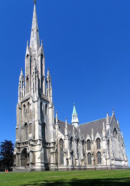
Anglicanism is strongest in Canterbury (the city of Christchurch having been founded as an Anglican settlement).
Catholicism is still has a noticeably strong presence on the West Coast, and in Kaikoura. The territorial authorities with the highest proportion of Catholics are Kaikoura (where they are 18.4% of the total population), Westland (18.3%), and Grey (17.8%).
Presbyterianism is strong in the lower South Island — the city of Dunedin was founded as a Presbyterian settlement, and many of the early settlers in the region were Scottish Presbyterians. The territorial authorities with the highest proportion of Presbyterians are Gore (where they are 30.9% of the total population), Clutha District (30.7%), and Southland (29.8%).
The first Muslims in New Zealand were Chinese gold diggers working in the Dunstan gold fields of Otago in the 1860s. Dunedin's Al-Huda mosque is the world's southernmost, and the farthest from Mecca.
Sport in New Zealand:
A number of national or international sporting teams and events are based in the South Island, including:
Basketball:
Canterbury Rams, Nelson Giants, Otago NuggetsCricket:
Central Stags, Canterbury Wizards, Otago VoltsFootball (soccer):
Canterbury United, Otago United.Ice hockey:
Canterbury Red Devils, Dunedin Thunder, Southern Stampede.Netball:
Canterbury Tactix, Southern Steel.Rugby league:
Canterbury BullsRugby union:
Crusaders, Highlanders (Super 15), Canterbury, Otago, Southland Stags, Tasman Makos (ITM Cup), Buller, South Canterbury, Mid Canterbury, North Otago, West Coast (Heartland Championship)The South Island occasionally hosts matches for North Island based teams who compete in Trans-Tasman sporting competition. Christchurch has hosted home fixtures for the Auckland-based New Zealand Breakers (basketball) and now-defunct Football Kingz FC (football), as well as fixtures for the Wellington-based Wellington Phoenix FC (football). Christchurch has also rugby league matches between the Auckland-based New Zealand Warriors and the Sydney-based Wests Tigers as the result of the Tigers relocating some of their home matches to Lancaster Park.
Christchurch also hosted the 1974 Commonwealth Games. An unidentified group is promoting a bid for the South Island to host the 2022 Winter Olympics.
South Island of New Zealand Pictures: